File:Ug-map.png

| Uploaded by | Béka~commonswiki |
|---|---|
| Upload date | 2011-07-13T00:06:10Z |
| MIME type | image/png |
| Dimensions | 330 × 354 px |
| File size | 55.7 KB |

|
This map image could be re-created using vector graphics as a SVG file. This has several advantages; see Commons:Media for cleanup for more information. If a SVG form of this image is available, please upload it and afterwards replace this template with
{{vector version available|new image name}}.It is recommended to name the SVG file “Ug-map.svg”—then the template Vector version available (or Vva) does not need the new image name parameter. |
Summary
| Description | Uganda map from CIA World Factbook, converted from original GIF format (July 2011 version showing South Sudan) |
| Date | |
| Source |
CIA World Factbook |
| Author | United States Central Intelligence Agency |
| Other versions |
|
Licensing

|
This image is in the public domain because it contains materials that originally came from the United States Central Intelligence Agency's World Factbook.
|
 |
Derivative works
Derivatives of 2002 map (not showing South Sudan):
-
 Kaart Oeganda-nl.png
Nederlands -
 Kaart Oeganda.png
Afrikaans -
 Mapa Ugandy.png
čeština -
 Ug-map-fr.png
français -
 Ug-map-HE.png
עברית -
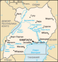 Ug-map-RU.png
русский -
 Uganda CIA map PL.png
polski -
 Uganda sm05 tr.gif
Türkçe


