File:Hungary 13th cent.png
Summary
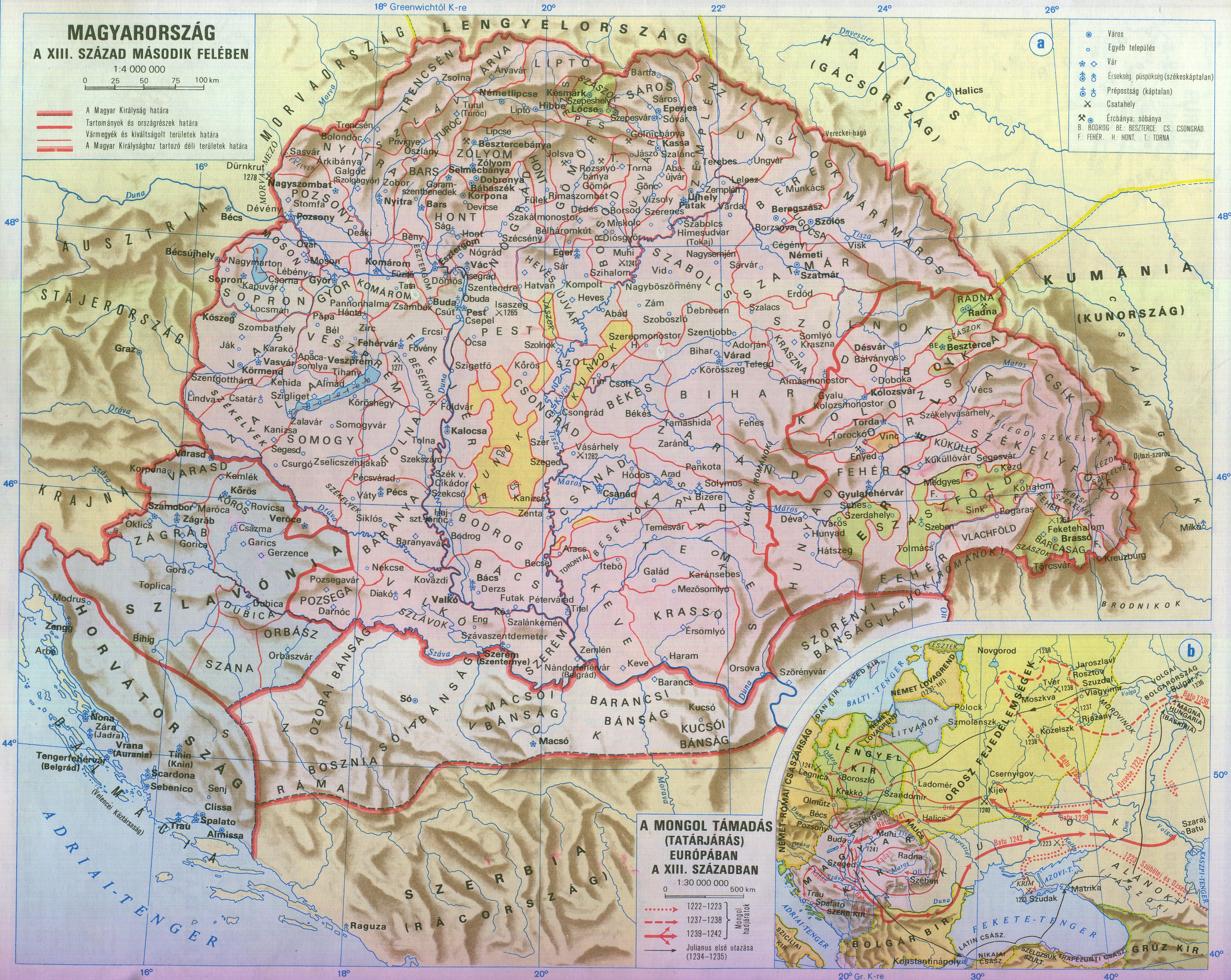
| Description | Kingdom of Hungary in the second half of the 13th century (including Kingdom of Croatia in personal union with Hungary) |
| Source | Own work (Based on academic map: https://djnaploja.files.wordpress.com/2015/11/magyar-kirc3a1lysc3a1g-xiii-sz.jpg) |
| Author | Fz22 |
Licensing
| I, the copyright holder of this work, release this work into the public domain. This applies worldwide. In some countries this may not be legally possible; if so: I grant anyone the right to use this work for any purpose, without any conditions, unless such conditions are required by law. |
Category:Banate of Severin
Category:Maps of Hungary in the 13th century
Category:Maps of Kunság
Category:Maps of Székely Land
Category:Maps of the Banate of Bosnia
Category:Maps of the history of Croatia in the Middle Ages
Category:Maps of the history of Hungary in the Árpád age
Category:Maps of the history of Mačva
Category:Maps of the history of Slavonia
Category:Maps of the history of Transylvania
Category:PD-self
Category:Self-published work
Category:Soli (region)
Category:Usora (region)
Category:Voivodeship of Transylvania