File:Radar-algorithme fr.gif

| Uploaded by | Pierre cb |
|---|---|
| Upload date | 2008-09-21T04:23:43Z |
| MIME type | image/gif |
| Dimensions | 383 × 473 px |
| File size | 45.9 KB |
| Description |
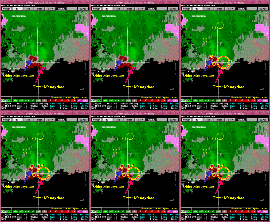
English: 1=Detection by the WSR-88D radar (NEXRAD) two mesocyclones with a supercell passing over Northern Michigan July 3rd, 1999 at 23:41 UTC. Thin yellow circles represent incipient or weak 3D vortex detections, Thick yellow and red circle represents a 3D vortex which has been classified as a mesocyclone, with its base detected at the 0.5 degree elevation sweep of the volume scan.
A tornado and associated mesocyclone are seen while to the east a larger area of rotation has developed.
Français : Détection de mésocyclones par un radar américain WSR-88D (NEXRAD) sur le nord du Michigan le 3 juillet 1999. Les minces cercles jaunes sont la détection d’une faible rotation en trois dimensions (3D) alors que le grand cercle jaune et rouge représente un mésocyclone 3D avec sa base détectée à l’angle le plus bas de 0,5 degré. Une tornade est associée avec la rotation à gauche alors qu’une zone de mésocyclone se développe à droite. |
||||||
| Date | Original done on July 3rd, 1999 | ||||||
| Source | French version of image of the web page Case Study - 03 July 1999 Northern Michigan by the National Severe Storm Laboratory | ||||||
| Author | Pierre_cb translation from work of Greg Stumpf, Pat Burke, Christina Hannon and Valerie McCoy of NSSL | ||||||
| Permission (Reusing this file) |
|
||||||
| Other versions | English original version File:Radar-algorithme eng.gif | ||||||