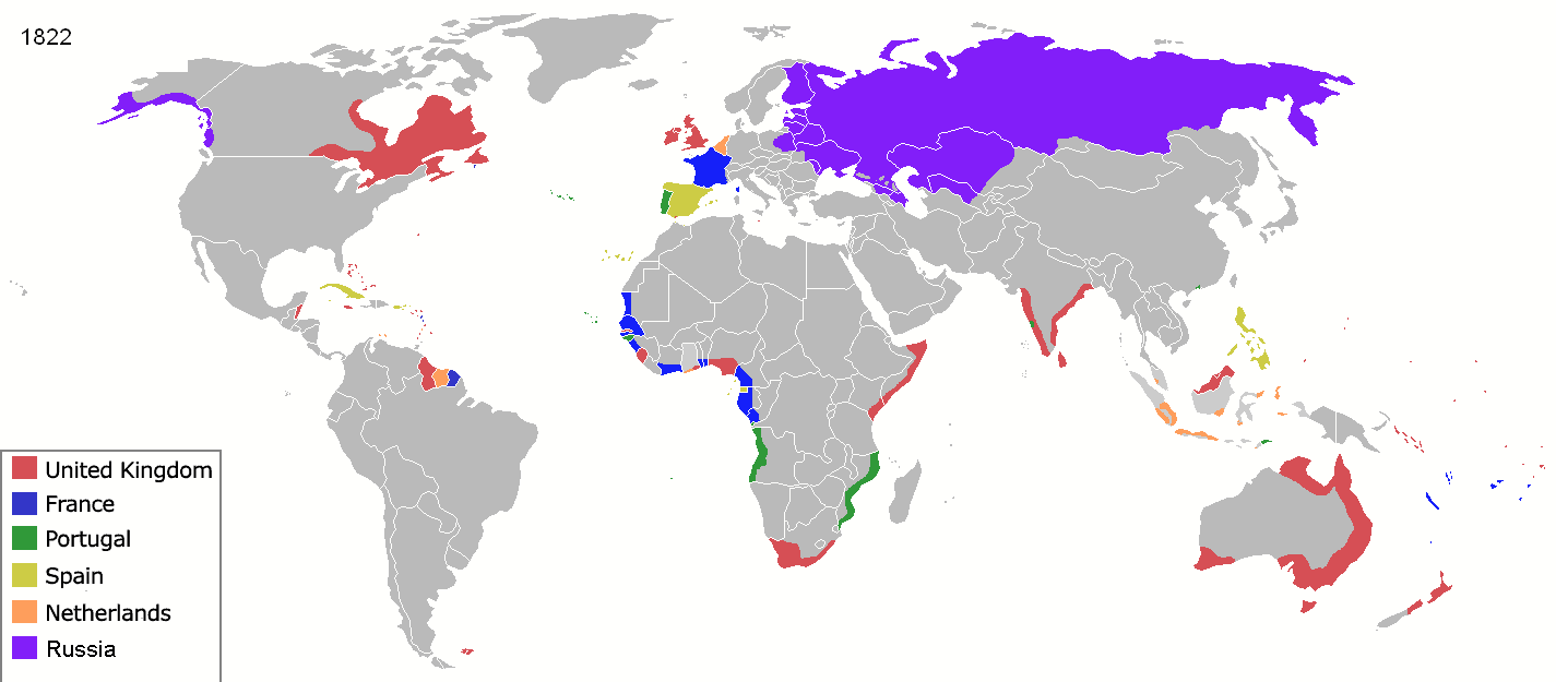
File:Colonisation 1822.png
| Uploaded by | M.Bitton |
|---|---|
| Upload date | 2022-03-17T23:57:04Z |
| MIME type | image/png |
| Dimensions | 1425 × 625 px |
| File size | 20.6 KB |
| Description |
Map of major world powers by year, derived from public domain animated map on wikipedia.
As the orriginal licence of the animation was Public Domain, this image which has been derived from it is too:
|
||||||||||||||||||
| Date | |||||||||||||||||||
| Source | public domain animated map by ArdadN here | ||||||||||||||||||
| Author | ArdadN | ||||||||||||||||||


.jpg)


._LOC_2001620596.jpg)


|
This historical map image could be re-created using vector graphics as a SVG file. This has several advantages; see Commons:Media for cleanup for more information. If a SVG form of this image is available, please upload it and afterwards replace this template with
{{vector version available|new image name}}.It is recommended to name the SVG file “Colonisation 1822.svg”—then the template Vector version available (or Vva) does not need the new image name parameter. |
| Annotations | This image is annotated: View the annotations at Commons |
