File:World map 1750.png
| Uploaded by | Babelia |
|---|---|
| Upload date | 2024-04-09T19:59:42Z |
| MIME type | image/png |
| Dimensions | 2920 × 1379 px |
| File size | 266.4 KB |
Summary
| Description |
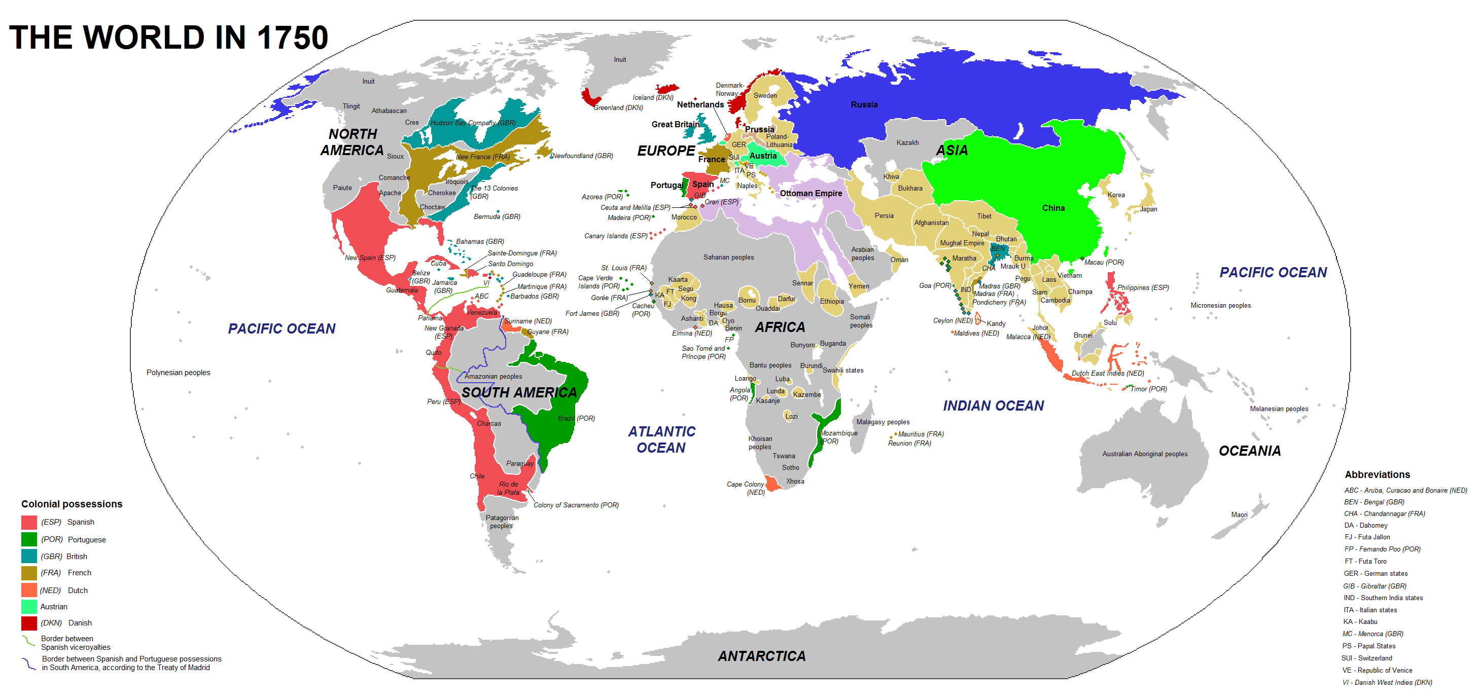
English: Main countries of the world in 1750. This is the base map |
| Date | |
| Source | Own work |
| Author | Babelia |

Licensing
I, the copyright holder of this work, hereby publish it under the following license:


This file is licensed under the Creative Commons Attribution 4.0 International license.
- You are free:
- to share – to copy, distribute and transmit the work
- to remix – to adapt the work
- Under the following conditions:
- attribution – You must give appropriate credit, provide a link to the license, and indicate if changes were made. You may do so in any reasonable manner, but not in any way that suggests the licensor endorses you or your use.