File:Edinburgh map.png
| Uploaded by | Jrockley |
|---|---|
| Upload date | 2009-11-08T00:03:10Z |
| MIME type | image/png |
| Dimensions | 734 × 573 px |
| File size | 69.2 KB |

|
File:Edinburgh Old Town Boundaries with New Town.svg is a vector version of this file. It should be used in place of this PNG file when not inferior.
File:Edinburgh map.png → File:Edinburgh Old Town Boundaries with New Town.svg
For more information, see Help:SVG. |
 |
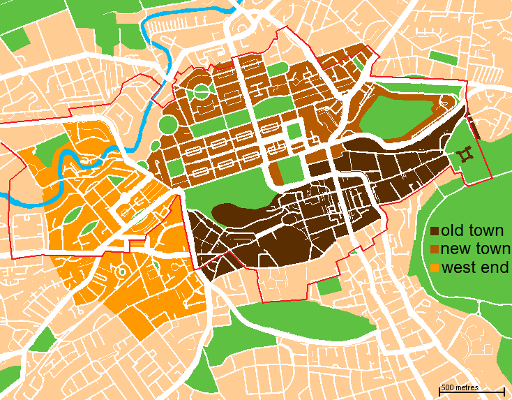
| Description | A map of the city centre of Edinburgh, Scotland. Old Town is in dark brown, New Town in light brown, West End is in yellow, and the World Heritage Site boundary is the red line. | ||
| Date | (UTC) | ||
| Source | Based loosely on http://www.aboutscotland.com/edin/newtown.html, updated based on the 'Edinburgh Navigator' maps. | ||
| Author | Jack · talk · | ||
| Permission (Reusing this file) |
|

|
I, the copyright holder of this work, release this work into the public domain. This applies worldwide. In some countries this may not be legally possible; if so: I grant anyone the right to use this work for any purpose, without any conditions, unless such conditions are required by law. |