File:Kentucky ref 2001.jpg
Summary
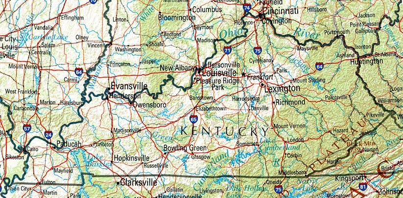
| Description |
Deutsch: Referenz-Karte Kentuckys. / Shaded relief map with state boundaries, forest cover, place names, major highways. Portion of "The National Atlas of the United States of America. General Reference", compiled by U.S. Geological Survey 2001, printed 2002 |
| Date | 6 September 2004 (original upload date) |
| Source | Aus der Perry Castañeda Library. / Perry-Castañeda Library Map Collection |
| Author | US Gov |
Licensing
Category:PCL
This work is in the public domain in the United States because it is a work prepared by an officer or employee of the United States Federal Government as part of that person’s official duties under the terms of Title 17, Chapter 1, Section 105 of the US Code.
Note: This only applies to original works of the Federal Government and not to the work of any individual U.S. state, territory, commonwealth, county, municipality, or any other subdivision. This template also does not apply to postage stamp designs published by the United States Postal Service since 1978. (See § 313.6(C)(1) of Compendium of U.S. Copyright Office Practices). It also does not apply to certain US coins; see The US Mint Terms of Use. |
 | |
| This file has been identified as being free of known restrictions under copyright law, including all related and neighboring rights. | ||
Category:CC-PD-MarkCategory:PD US Government#Kentucky%20ref%202001.jpg
Original upload log
Transferred from de.wikipedia to Commons by Nachcommonsverschieber using CommonsHelper.
The original description page was here. All following user names refer to de.wikipedia.
- 2004-09-06 07:03 Herrick 823×405× (245447 bytes) Referenz-Karte Kentuckys. Aus der Perry Castaneda Library. Public Domain