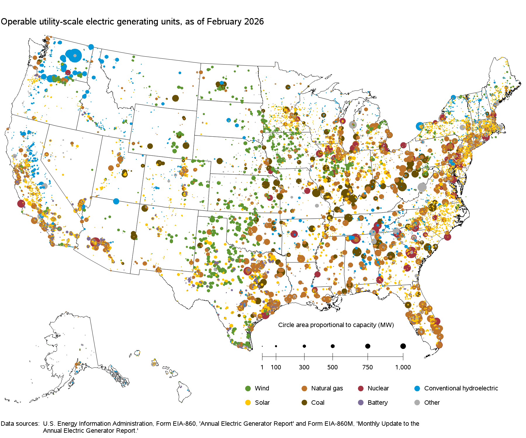
File:Power plants map.png
| Uploaded by | LucasBrown |
|---|---|
| Upload date | 2026-04-01T01:52:25Z |
| MIME type | image/png |
| Dimensions | 1800 × 1500 px |
| File size | 275.8 KB |
 Any autoconfirmed user can overwrite this file from the same source. Please ensure that overwrites comply with the guideline.

|
This file may be updated to reflect new information. If you wish to use a specific version of the file without it being overwritten, please upload the required version as a separate file. |
Summary
| Description |
English: Map of all utility-scale power plants in the USA |
| Source | https://www.eia.gov/electricity/data/eia860m/ |
| Author | EIA |
Licensing

|
This image is a work of a United States Department of Energy (or predecessor organization) employee, taken or made as part of that person's official duties. As a work of the U.S. federal government, the image is in the public domain.
Please note that national laboratories operate under varying licences and some are not free. Check the site policies of any national lab before crediting it with this tag.
|

|
Original upload log
The original description page was here. All following user names refer to en.wikipedia.

| Date/Time | Dimensions | User | Comment |
|---|---|---|---|
| 2016-11-22 20:00:12 | 1783× 1278× | Wikideas1 | Cropped |
| 2016-11-22 17:32:49 | 1800× 1500× | Wikideas1 | {{Information | Description = Power plants map of the United States | Source = http://www.eia.gov/electricity/data/eia860m/ | Date = 22 November 16 | Author = [[File:Wikideas.jpeg|20px|link=User:Wikideas1|Wikideas1]] [[U... |