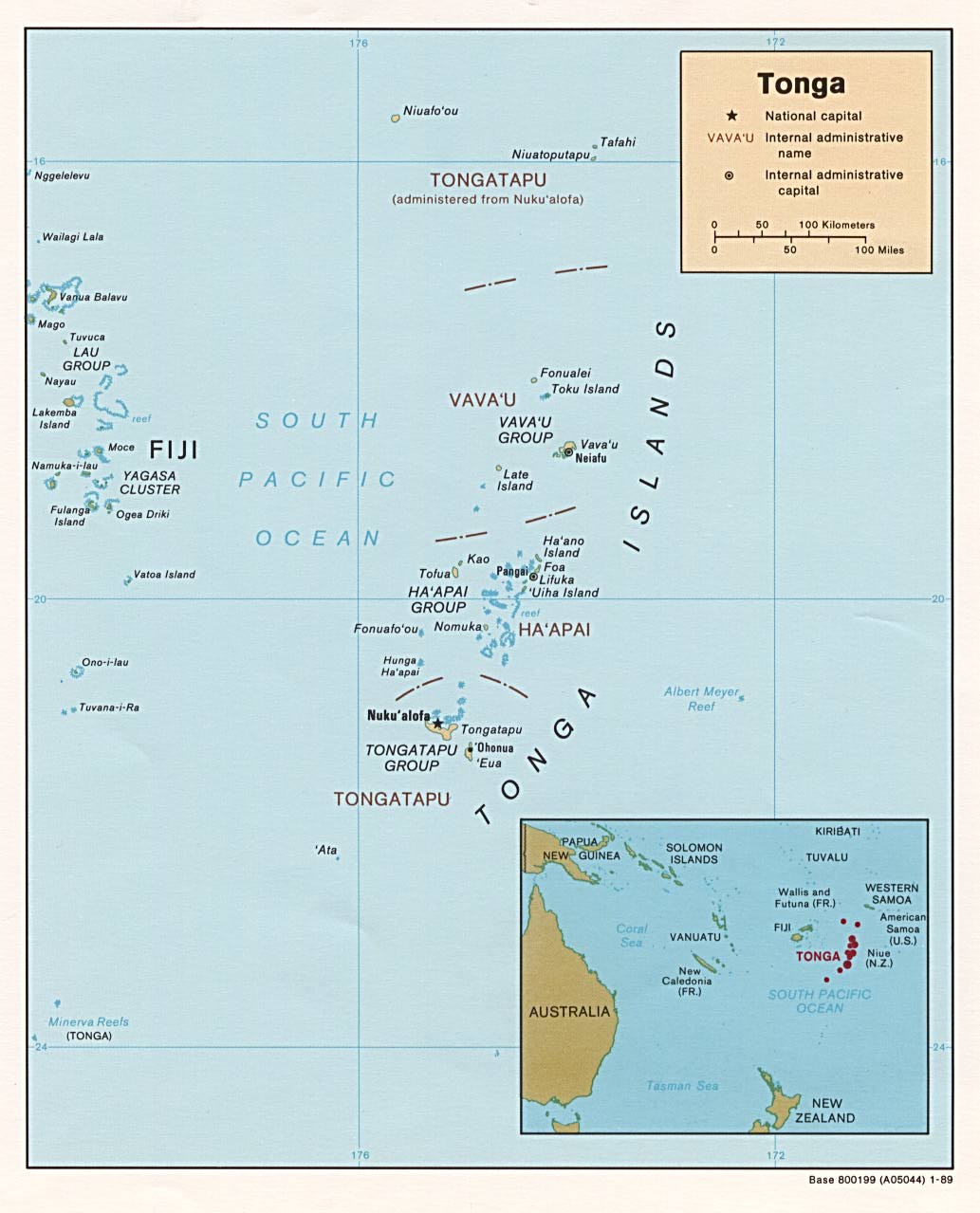
File:Tonga.jpg

| Uploaded by | George McFinnigan |
|---|---|
| Upload date | 2005-10-22T09:32:51Z |
| MIME type | image/jpeg |
| Dimensions | 1033 × 1279 px |
| File size | 132.4 KB |

|
This map image could be re-created using vector graphics as a SVG file. This has several advantages; see Commons:Media for cleanup for more information. If a SVG form of this image is available, please upload it and afterwards replace this template with
{{vector version available|new image name}}.It is recommended to name the SVG file “Tonga.svg”—then the template Vector version available (or Vva) does not need the new image name parameter. |


Summary
http://www.lib.utexas.edu/maps/islands_oceans_poles/tonga.jpg
Licensing



|
This image is a work of a Central Intelligence Agency employee, taken or made as part of that person's official duties. As a Work of the United States Government, this image or media is in the public domain in the United States.
|

|
Other version

Category:CIA World Factbook maps of Tonga
Category:Files with no machine-readable author
Category:Files with no machine-readable source
Category:JPG images that should use vector graphics
Category:Map images that should use vector graphics
Category:Media missing infobox template
Category:PCL
Category:PD CIA