File:Diadochen1.png
Summary
| Description |
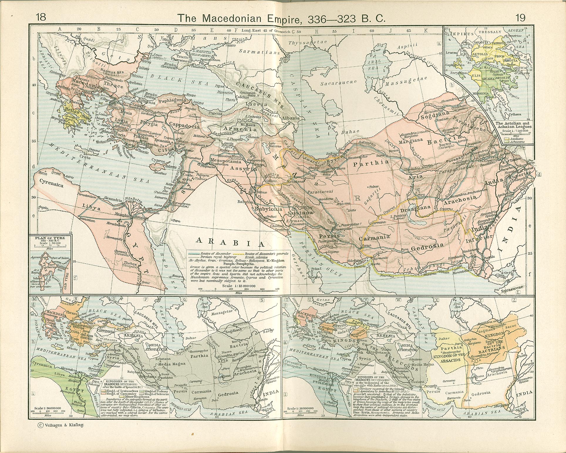
English: States of the Diadochi, c. 300 BC
Español: Imperio tolemaico (azul)
Nederlands: De diadochenrijken in 300 v.Chr.
Македонски: Дијадошки држави, околу 300 гпне |
| Date | |
| Source | Own work; The Macedonian Empire, 336-323 B.C. AND Kingdoms of the Diadochi in 301 BC and 200 BC. Historical Atlas by William R. Shepherd, 1911. Courtesy of the University of Texas Libraries, The University of Texas at Austin. |
| Author | Captain_Blood |
| Other versions |
[]
|


.PNG)


 |
This historical map image could be re-created using vector graphics as an SVG file. This has several advantages; see Commons:Media for cleanup for more information. If an SVG form of this image is available, please upload it and afterwards replace this template with {{vector version available|new image name}}.It is recommended to name the SVG file “Diadochen1.svg”—then the template Vector version available (or Vva) does not need the new image name parameter. |
Summary
The map has been created with the Generic Mapping Tools: https://www.generic-mapping-tools.org/ using one or more of these public-domain datasets for the relief:
|
 |
Permission is granted to copy, distribute and/or modify this document under the terms of the GNU Free Documentation License, Version 1.2 or any later version published by the Free Software Foundation; with no Invariant Sections, no Front-Cover Texts, and no Back-Cover Texts. A copy of the license is included in the section entitled GNU Free Documentation License. |
| This file is licensed under the Creative Commons Attribution-Share Alike 3.0 Unported license. | ||
| ||
| This licensing tag was added to this file as part of the GFDL licensing update. |
Category:CC-BY-SA-3.0-migrated
Category:Cassander
Category:GFDL
Category:GFDL-GMT
Category:German-language maps showing history
Category:Historical map images that should use vector graphics
Category:License migration completed
Category:Maps of Ptolemaic Egypt
Category:Maps of the Kingdom of Lysimachus
Category:Maps of the Seleucid Empire
Category:Maps of the partition of the Macedonian Empire
Category:Maps showing the 300s BC
Category:PNG that should use vector graphics