File:Osterseen.svg
| Uploaded by | HerrAdams |
|---|---|
| Upload date | 2016-06-02T20:21:31Z |
| MIME type | image/svg+xml |
| Dimensions | 1143 × 1331 px |
| File size | 7.1 MB |
Summary
| Description |
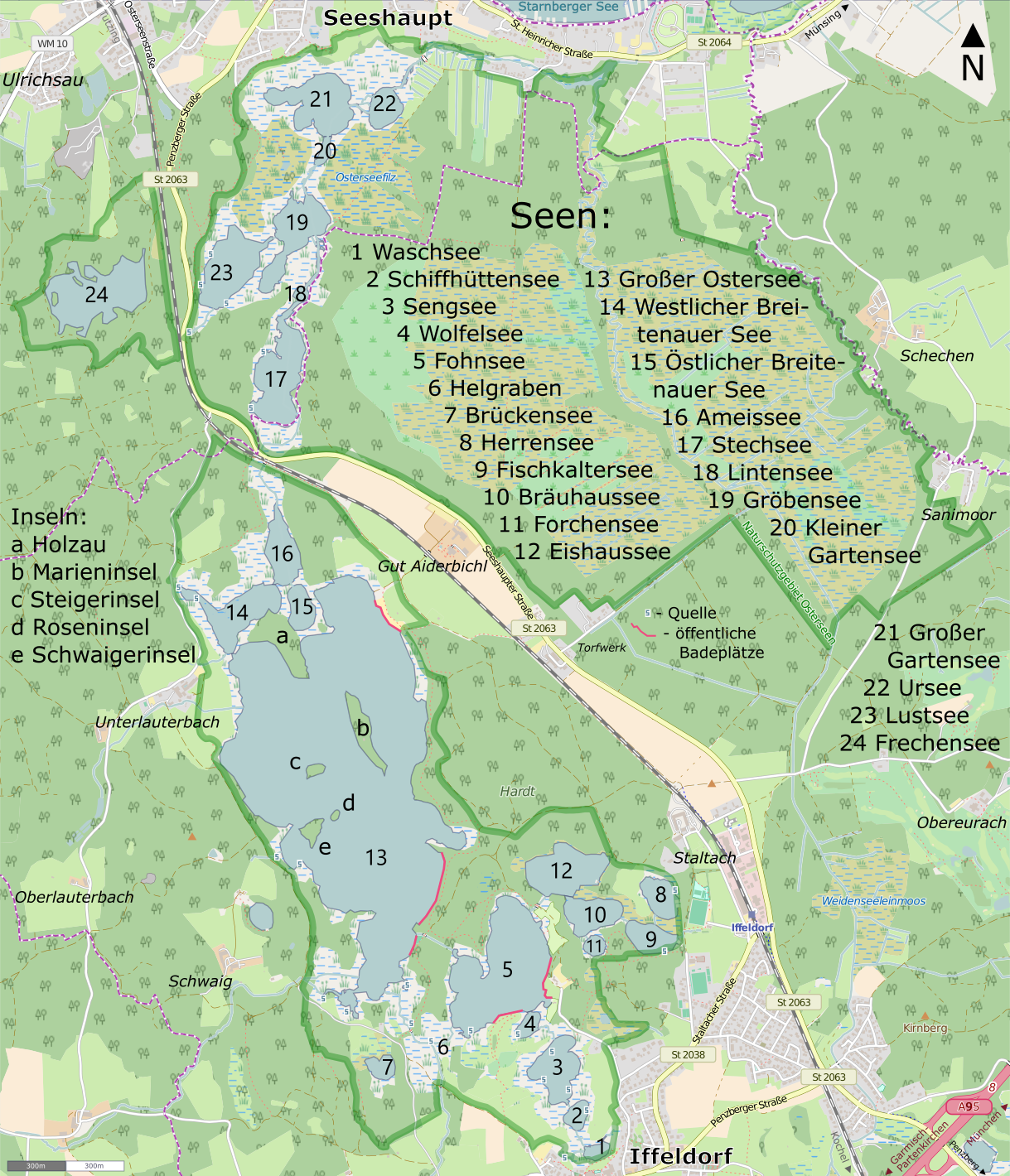
Deutsch: Karte der Osterseen in Oberbayern English: Map of the Osterseen, Upper Bavaria, Germany |
|||||||||
| Date | ||||||||||
| Source | You may find a page on the OpenStreetMap wiki page for Iffeldorf | |||||||||
| Creator |
Own work OpenStreetMap contributors |
|||||||||
| Permission (Reusing this file) |
OpenStreetMap data is available under the Open Database License (details). Map tiles are licensed under the Creative Commons Attribution-ShareAlike 2.0 license (CC-BY-SA 2.0).
   This file is licensed under the Creative Commons Attribution-Share Alike 2.0 Generic license.
|
|||||||||
| Geotemporal data | ||||||||||
| Bounding box |
|
|||||||||
| Georeferencing | If inappropriate please set warp_status = skip to hide. | |||||||||


