File:Volgarivermap.png
| Uploaded by | Kmusser |
|---|---|
| Upload date | 2007-07-23T17:06:38Z |
| MIME type | image/png |
| Dimensions | 500 × 500 px |
| File size | 154.6 KB |

|
This map image could be re-created using vector graphics as a SVG file. This has several advantages; see Commons:Media for cleanup for more information. If a SVG form of this image is available, please upload it and afterwards replace this template with
{{vector version available|new image name}}.It is recommended to name the SVG file “Volgarivermap.svg”—then the template Vector version available (or Vva) does not need the new image name parameter. |
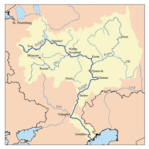
This is a map of the Volga River system. I, Karl Musser, created it based on USGS data.
I, the copyright holder of this work, hereby publish it under the following license:


This file is licensed under the Creative Commons Attribution-Share Alike 2.5 Generic license.
- You are free:
- to share – to copy, distribute and transmit the work
- to remix – to adapt the work
- Under the following conditions:
- attribution – You must give appropriate credit, provide a link to the license, and indicate if changes were made. You may do so in any reasonable manner, but not in any way that suggests the licensor endorses you or your use.
- share alike – If you remix, transform, or build upon the material, you must distribute your contributions under the same or compatible license as the original.
derivative works
Derivative works of this file:


Category:CC-BY-SA-2.5
Category:Drainage basin maps of Europe
Category:Files with derivative versions
Category:Files with no machine-readable author
Category:Files with no machine-readable source
Category:Map images that should use vector graphics
Category:Maps of rivers of European part of Russia
Category:Maps of the Volga
Category:Media missing infobox template
Category:PNG that should use vector graphics
Category:Self-published work
Category:Volga Basin