Oahu
English: Oahu is the third largest of the Hawaiian Islands and most populous island in the State of Hawaii.
haw: Oʻahu
Category:Uses of Wikidata Infoboxisland of Hawaii, United States  Satelitní snímek ostrova Oahu  | |||||
| Upload media | |||||
| Instance of | |||||
|---|---|---|---|---|---|
| Part of | |||||
| Location | Honolulu County, Hawaii | ||||
| Located in or next to body of water | |||||
| Width |
| ||||
| Length |
| ||||
| Highest point | |||||
| Population |
| ||||
| Area |
| ||||
| Elevation above sea level |
| ||||
| Different from | |||||
 Category:Uses of Wikidata Infobox with maps Category:Uses of Wikidata Infobox with maps | |||||
| |||||
Honolulu
 Bishop Museum
 Downtown Honolulu as seen from Iolani Palace
 Aerial view of Honolulu (with Aloha Tower)
 Aerial view of Honolulu
 Aerial view of Honolulu (with Waterfront Towers Condos)
 Aerial view of Honolulu (with Magic Island, Ala Moana Beach Park, Ala Wai Yacht Harbor)
 Aerial view of Honolulu (with Halekulani, Sheraton hotels)
 Aerial view of Honolulu (with blue waters of Waikiki Beach)
 Aerial view of Honolulu (with Waikiki Beach and Kapiolani Park)
 Aerial view of Honolulu (from Diamond Head point)
 Aerial view of Honolulu (with Honolulu Airport, H-1, and Navy-Marine Golf Course)
 Departing from Honolulu International Airport, viewing at the port of Honolulu
 Pearl Harbor, Hawaii (Aug. 29, 2003)
 Aloha Tower lights the night sky of Honolulu Harbor.


Oahu

 Oahu map
 Oahu location map
 Diamond Head Kapiolani Park
 Aerial view of Hanauma Bay
 Aerial view of Lanai lookout
 Ground view of Lanai lookout (north)
 Ground view of Lanai lookout (south)
 Ground view of north shore
 Aerial view of Ko'olau mountains
 Aerial view of Ko'olau mountains (with Koko Head Crater)
 Aerial view of Ko'olau mountains (with H-3 tunnels)
 Aerial view of Sacred Falls
 Aerial view of Sacred Falls
 Aerial view of Dole Pineapple Maze, largest maze in the world (far)
 Aerial view of Dole Pineapple Maze (near, but blurry)
 Aerial view of battleship docked in Pearl Harbor
 Aerial view of USS Arizona Memorial
 Aerial view of F-177 Stealth Fighter on runway at Honolulu airport
 Aerial view of Puuikena Drive (winding mountain road)
 Aerial view of Anapalau Street (island neighborhood/subdivision)
 Kaneohe Bay
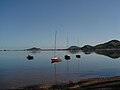 Kaneohe Bay
 Kaneohe Bay
 A view from the Pali Gap towards the Windward Coast on the island of Oahu
 Makua Valley, West Oahu
 Nuʻuanu Pali

.png)


Hotels
 Balcony view of Halekulani pool and beach area (Diamond Head in background)
 Halekulani balcony view of Lewers Street
 Halekulani balcony view of Diamond Head and surfers on Waikiki Beach
 Halekulani balcony view (vertical) of Halekulani pool and beach area (Diamond Head in background)
 Oahu Ihilani resort


Misc.
 Tourist helicopter
 Bishop Museum display of cannibal fork
 Bishop Museum display of Polynesian totem art
 Bishop Museum
 "Stop Driving" sign at Kaneohe Bay Drive, Oahu, Hawaii
 Kapok planted in the Foster Botanical Garden, Honolulu, Hawaii.
 A Brown Booby in Oahu.
 Rabbit Island


Sports
 North Shore surfing
 North Shore surfing
 North Shore surfing
 North Shore surfing
 North Shore surfing
 North Shore surfing


